


Who is this creator?
No community tags yet.
DCS Terrain SRTM1 Files for CombatFlite and Tacview - South Atlantic Theater
Oct 11, 2026 0
DCS Terrain SRTM1 Files for CombatFlite and Tacview - Cold War Germany Theater
Sep 30, 2026 0
DCS Terrain SRTM1 Files for CombatFlite and Tacview - Nevada Theater
Sep 23, 2026 0
DCS Terrain SRTM1 Files for CombatFlite and Tacview - Sinai Theater
Sep 16, 2026 0
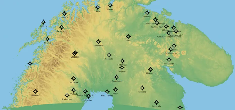
DCS Terrain SRTM1 Files for CombatFlite and Tacview - Kola Theater
As a follow-up of this previous post, you'll find here the next theater: Kola. Please refer to that original post for installation details!
Sep 9, 2026 0 12

DCS Terrain SRTM1 Files for CombatFlite and Tacview - Caucasus Theater
As a follow-up of this previous post, you'll find here the next theater: Caucasus. Please refer to that original post for installation details!
Sep 6, 2026 0 12

DCS Terrain SRTM1 Files for CombatFlite and Tacview - Afghanistan Theater
Hi all! I am initiating the release of several .hgt terrain file packs designed to support more accurate DCS World mission planning and debriefing. For those who followed my very first posts, back in 2024, I distributed at that time real-world .hgt files for various DCS theaters, specifically focusi
Sep 4, 2026 0 62

Elevation Data for Sinai Theater
Just like for the dataset for other theaters, I'm sharing here the .hgt files for Sinai theater in CombatFlite. Just like for the dataset for the Kola, Iraq, Afghanistan, South Atlantic or CW Germany theaters, I'm sharing here the .hgt files for Sinai theater which should be copy/pasted into your [.
Jul 20, 2025 0 2

Cold War Germany Elevation Map for CombatFlite
You'll find here a topographical map with rivers for Germany. You'll find here a topographical map with rivers for Germany. It's very useful when you want to be able to read terrain features and select the best low level path to your target area. I remind you that I explained in one of my first post
May 11, 2025 0 4
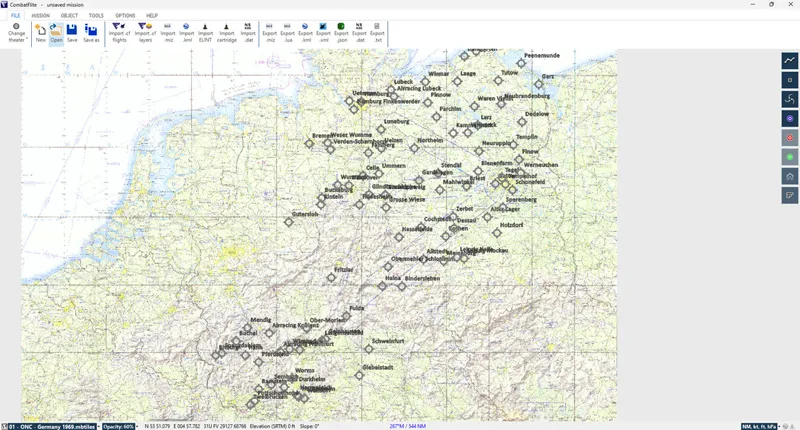
Creating a Cold War Germany Theater for CombatFlite
All the files necessary to add Ugra Media's CW Germany theater for CombatFlite are now available in the shop. Combat Pilot members can access them already, other members will have to wait a little until all these files are released (one .mbtiles map every Sunday, as usual now). Without going back in
Apr 29, 2025 0 2

Elevation Data for Cold War Germany Theater
SRTM files for CW Germany theater by Ugra Media for use in CombatFlite Since there's a real hype around the newly released Cold War Germany theater for DCS World by Ugra Media, I decided to invest a little time to create or gather all the files necessary to use this latest theater in CombatFlite. As
Apr 24, 2025 0 1

Update: Afghanistan Digital Elevation Model for CombatFlite
These are the .hgt files for Afghanistan theater in order to use DEM-dependant tools in CombatFlite. The .hgt files for Afghanistan that I shared in one of my first posts were formerly hosted on a Telegram channel due to file size limitations on Patreon. Since they have increased the maximum attachm
Mar 28, 2025 0 1

Off Topic: Elevation Data for South Atlantic Theater
As of follow up of the previous releases, (Kola and Iraq theaters), you can find here the .hgt files for South Atlantic theater. As of follow up of the previous releases, (dataset for the Kola theater and Iraq theater), I'm sharing here the .hgt files for South Atlantic theater which should be copy/
Mar 9, 2025 0 1
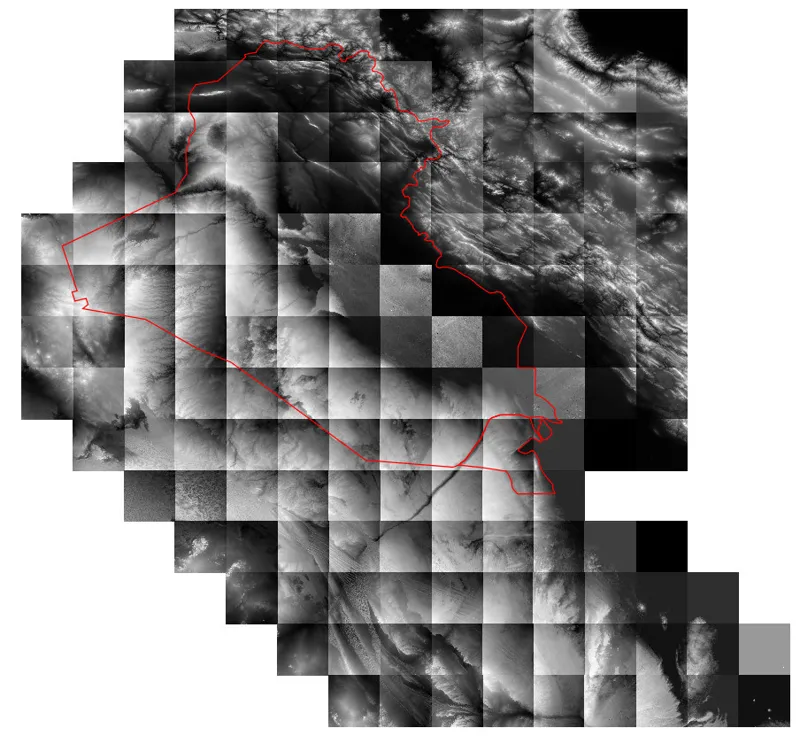
Off Topic: Elevation Data for Iraq Theater
Just like for the dataset for the Kola theater, I'm sharing here the .hgt files for Iraq theater. Just like for the dataset for the Kola theater, I'm sharing here the .hgt files for Iraq theater which should be copy/pasted into your [...]/CombatFlite/SrtmDataFiles folder. Note: as a reminder, all th
Mar 2, 2025 0 1

Custom Maps for Mission Planning & Execution
Over the past few months, I have created numerous maps to support mission planning and execution in DCS World. These maps come in various formats, from high-resolution images to specialized files like .mbtiles for CombatFlite or ForeFlight and .pdf for high-quality printing. Example of ESRI map in .
Feb 28, 2025 0 10
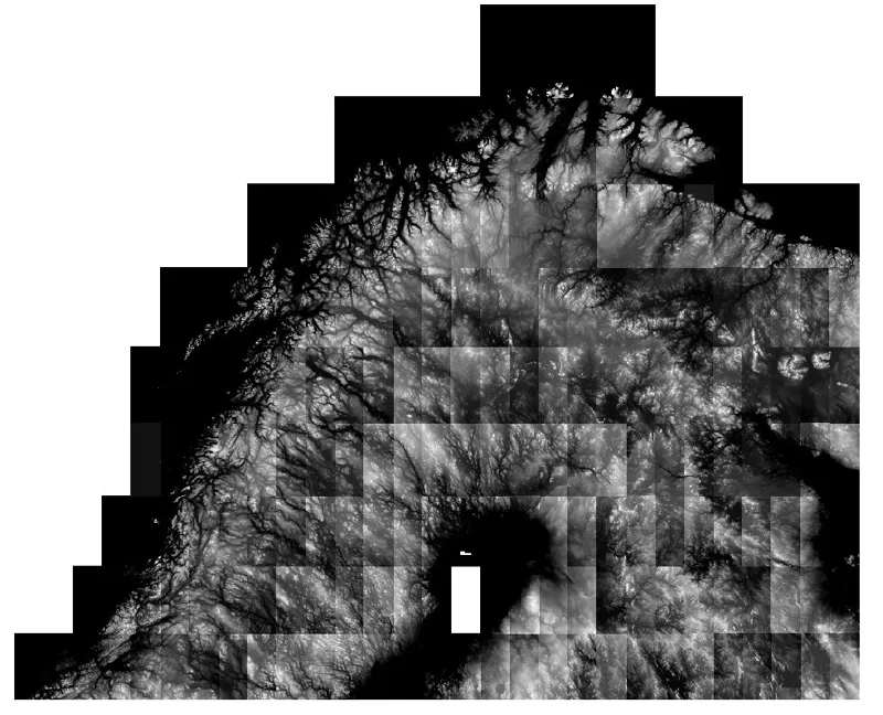
Off Topic: Elevation Data for Kola Theater
Elevation data (.hgt) for Kola theater. Since it seems that despite my previous attempts to explain how to retrieve the elevation data, some people are having trouble finding the dataset for the Kola theater, I'm sharing here the .hgt files which should be copied/pasted into your [...]/CombatFlite/S
Feb 22, 2025 0 1