













Visiting Afghanistan with DCS (2/3)
Leaving the dense urban area of Kabul behind, the second part of our visit focuses on the vast expanses that define the rest of the Afghan theater. We will first identify the few unique modeled objects located in Herat and Kandahar, and then we will highlight several remarkable geological landmarks. These natural features are clearly visible from high altitude, and I hope they help you appreciate the true beauty of this landscape, moving beyond a purely combat perspective to see the environment as we do from the cockpit.
II. Unique Objects - Kandahar and Herat
Beyond the capital, there's unfortunately barely no unique object modeled... It is a limitation that doesn't quite do justice to the architectural and historical richness of the provinces, where dozens of landmarks, ranging from ancient citadels to beautiful shrines, hold a real cultural or tactical importance. While we hope future updates to the DCS map will expand this library, there are currently two essential landmarks in the southern and western regions that you should be able to identify.
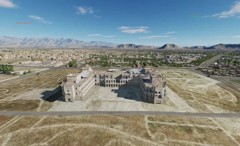
II.1 - Kandahar: Mausoleum of Ahmad Shah Durrani
In the heart of Kandahar lies the tomb of the "Father of Afghanistan": Ahmad Shah Durrani founded the modern state in 1747, and his shrine is the spiritual and political center for the Pashtun heartland. This site and the adjacent Friday Mosque (or Shrine of the Cloak, not modeled in DCS) was obviously a strict "no-strike" zone of the highest order. Any collateral damage here would have had catastrophic strategic repercussions across the entire Afghan theater.
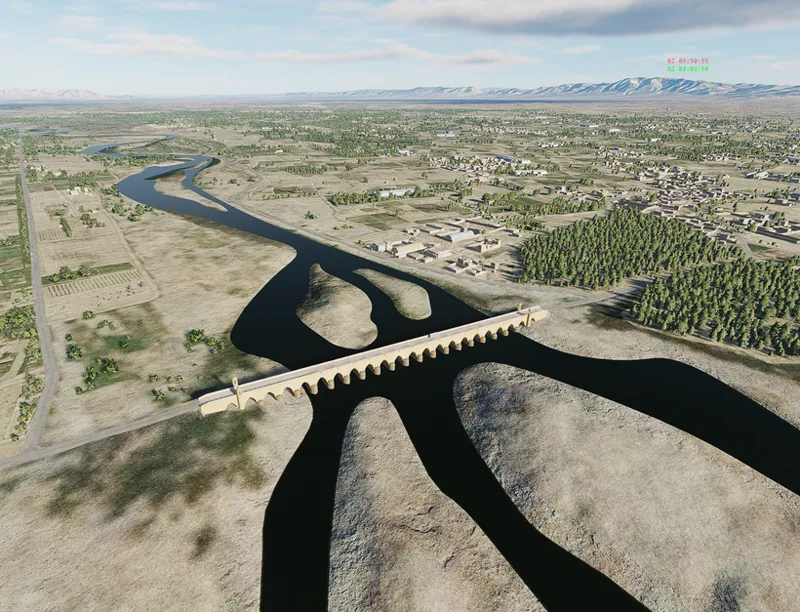
II.2 - Herat: Malan Bridge
This 22-arch bridge over the Hari River dates back to the 12th century. It is a critical infrastructure point south of Herat. Historically, it was the only bridge connecting Herat to Kandahar for centuries. During the Soviet-Afghan War, it was partially destroyed and later rebuilt.It reminds us the strategic importance of river crossings in general.
III. Natural and Historical Landmarks: Afghanistan from Altitude
III.1 - Natural Landmarks
III.1.1 - Nowshak Peak & Tirich Mir
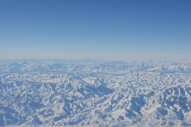
At 7,492 meters (24,580 ft), Nowshak is the highest point in Afghanistan and the second-highest independent peak of the Hindu Kush range. The first highest independent peak in the Hindu Kush range is Tirich Mir, which reaches an elevation of 7,708 meters (25,289 ft). This last peak is located entirely within the Chitral District of Pakistan, just across the border from Afghanistan. Because it sits in Pakistan, Nowshak (7,492 meters) holds the title of the highest peak in Afghanistan and the second-highest in the entire range.
In DCS, if you are flying near the border in the northeast, Tirich Mir is the massive "king" of the skyline that sits just to the east of Nowshak. Together, they form a colossal gateway of rock and ice that dominates the high-altitude horizon.
III.1.2 - The Wakhan Corridor
This narrow strip of territory, wedged between Tajikistan, Pakistan, and China, is one of the most remote places on Earth. From the cockpit, it appears as a beautful high-altitude valley floor flanked by massive glacial walls.
Note: despite flying hundreds of combat missions over Afghanistan, I was never tasked in this sector. For once, I have no photos from the cockpit to share!
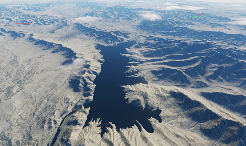
III.1.3 - Kajaki Lake and Dam
A startling splash of turquoise blue against the arid, tan hills of Helmand Province, this reservoir was created by the Kajaki Dam. The contrast between the water and the surrounding desert makes it one of the most easily identifiable landmarks in southern Afghanistan.
III.1.4 - Tangi Tashkurgan Gorge
This dramatic limestone gorge in the north is where the Samangan River cuts through the mountain range to reach the plains of Mazari Sharif. The sheer vertical walls of the "Gate of the Iron House" offer some of the most challenging and visually stunning low-level "canyon running" opportunities in the theater.
III.1.5 - Dasht-e Nawar (The Salty Lake)
High in the Ghazni highlands sits this massive salt flat. Depending on the season, it appears as a shimmering white expanse or a shallow, turquoise mirror. It is a surreal, alien landscape that looks more like the surface of the moon than the rugged mountains surrounding it.
III.1.6 - The Registan Desert
To the south of Kandahar lies the "Desert of Hope", a vast plateau of red sand dunes and cracked earth. From altitude, the wind-sculpted patterns of the dunes create a beautiful texture. It is a place of extreme beauty and absolute lethality, representing the unforgiving southern border of the Afghan theater.
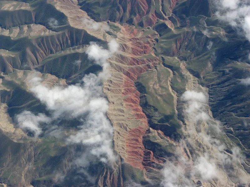
III.1.8 - The "Painted Mountains"
One of the most striking features of the Afghan geology is the sudden transition of mineral colors. In certain sectors, you will fly over ridges that transition from deep ochre reds to cold, slate greys and even pale, mineral blues. Some of these color shift are very well represented in DCS.
III.2 - Military Landmarks
While the Afghan landscape is visually stunning in general, its beauty is often inseparable from its history. Many of these peaks and valleys are remarkable not just for their dramatic relief, but for the events that took place within them. Let's visit some of them.
III.2.1 - Takur Ghar
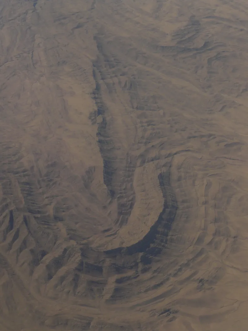
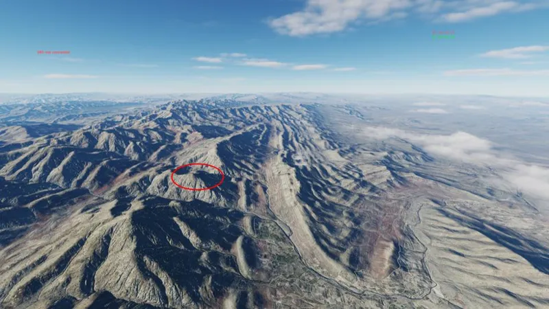
Takur Ghar is synonymous with the Battle of Roberts Ridge. In March 2002, during Operation Anaconda, this 10,469-foot peak became the site of a harrowing engagement after a SEAL, PO1 Neil Roberts, fell from a damaged MH-47 Chinook. The rescue attempts led to the loss of seven American service members. It is also located next to one of the most stunning geological landscape in the whole theater!
III.2.2 - The Sangin Triangle (Sangin, Musa Qala, Kajaki)
This area in northern Helmand became synonymous with some of the conflict's fiercest fighting. Defined by the lush "Green Zone", it was a tactical nightmare. Even at the height of the "surge", coalition forces struggled to maintain a foothold in the remote Musa Qala district.
Together with the Kajaki Dam, a strategic energy hub for Southern Afghanistan, and Sangin, the geographic "bolt" locking down the northern valley, these locations remained perpetually contested. The Taliban were fighting in their own backyard, using the dense irrigation treelines and mud-walled compounds to their advantage. For Western forces, trying to stabilize this triangle was a task that often felt virtually impossible.
III.2.3 - The Panjshir Valley
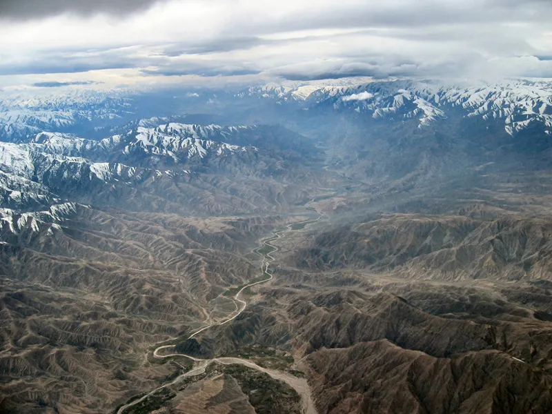
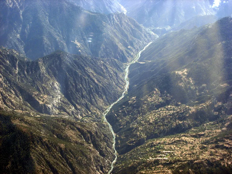
The Panjshir Valley is a valley carved by the Panjshir River and flanked by the peaks of the Hindu Kush. From the air, the valley floor appears as a beautiful emerald ribbon stuck between walls of rock that rise thousands of feet.
Historically, this valley is the heart of the resistance. It was here that Ahmad Shah Massoud and his troops fought the Soviets during the 1980s. His forces repelled nine distinct Soviet offensives, turning the narrow entrance of the valley into a graveyard for armored columns. Later, as the leader of the Northern Alliance (the United Islamic Front), Massoud transformed the Panjshir into an unconquerable bastion against the Taliban.
III.2.3 - Korengal Valley
Let's put it bluntly: Korengal Valley is a trap. Located in the Kunar Province near the Pakistan border, this relatively small area became one of the most dangerous assignments for U.S. forces. The relentless fighting that took place there was immortalized in the documentaries Restrepo and Korengal.
III.2.4 - Tarinkot & the Chora Valley
The Chora Valley in Uruzgan Province is a corridor for movement between the south and the central highlands. Don't hesitate to have a look at this previous video to discover some of the events that took place there.
Conclusion
The list of breathtaking places in Afghanistan is truly endless: in a theater this vast and varied, it is impossible to cover every significant peak or hidden valley. To those whose favorite landmarks were missed, I offer my apologies, there simply isn't enough space to do justice to every corner of this incredible map.
My hope is that this short guide sparks a desire in you to explore the theater beyond the mission objectives, if only to witness the raw beauty of the landscape. Like so many who served in Afghanistan, I walked away deeply moved by two things: the resilience of its people and the staggering majesty of the environment. Of all the places I have seen, this land remains the one that struck me most profoundly. I truly hope I have managed to convey at least a fraction of that awe through these descriptions.
In a following post, I will share the coordinates and materials you need to find these locations yourself. I will also take the opportunity to introduce a flight planning tool that has become indispensable: MissionPlot. Specifically, I heavily relied on its ISR feature, which bridges the gap between the DCS camera and mission planning software.
25 Beautiful Places in Afghanistan That Left Me Speechless | 4K Travel Documentary (YouTube)