




SNAKE PASS, UK - LIDAR Point Cloud Data
Hello friends
For the past few days, I've been studying about how to use LIDAR Point Cloud data in my track building. Actually back in 2015, I tried to build Glendora Mountain Road using LIDAR but no luck and I lost the project. My other tracks are Japanese mountain pass with no free LIDAR covered I can use.
Thanks to Markus Howell for suggesting to use LIDAR
I began by searching for point cloud data in the Peak District area, then selected and downloaded the area I needed. The files are in LAZ format.
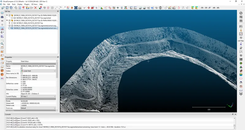
I used CloudCompare to view the files.
Cut the area that I wanted and save it in CSV format. Please note that this is just a rough test.
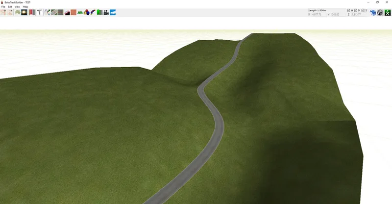
I'm still using BTB Pro to build basic road and terrain. So I just imported that CSV file and as you can see picture below, it worked like a charm.
I traced the road and then the program calculated the road mesh and merged it perfectly into those points.
Same with the terrain.
Done with the test and experiment. It took a lot of trial and error, but I finally figure it out.
Point cloud data is one of the best ways to obtain accurate road and terrain elevation. It’s not as precise as a full laser scan, but for now, it provides everything I need to build a realistic and amazing mountain pass.
That's it. Wish me luck. Have a nice day and happy racing... :)
Comments (7)
Still looking forward for this track mate , I drove snakepass last year , it was one of my best mountain drive I had
You should really look at all the back roads around Bradfield to! And the Hope Valey/MamTor area. Used to fly drones so I might be able to help but I lack time.
I find it fascinating how Genki laser scanned the touges used in TXRD2 back in 2006. Yet, no one has figured out how to port any of it to Assetto Corsa.
Feel free to extend on that tail of the dragon area.. ex.. Cherokee NC into Gatlinburg, through Pigeon Forge. Thats such a beautiful area and a very highly rated tourist attraction area as well! Tail of the Dragon was so good.. left me craving more 😩
fr, Gat and Pigeon Forge are awesome
Thanks so much for sharing what's used behind the curtain! Is this the same process used for the Tail of the Dragon map or was that done with the more manual previous method?
Dragon and my other old track use KML data and API data to get basic elevation. More manual and "this feel right" method I can say. Point Cloud method more accurate and made modding track more easier