



[Update] Jagged Coastlines (v1.119.0)
Fantasy Map Generator continues to evolve. Here is an overview of the latest changes.
Jagged Coastlines
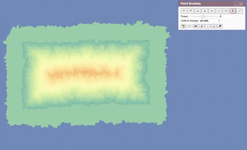
The most important update is the new coastline fracturing system. Instead of perfectly smooth Voronoi-based borders, coastlines are now procedurally roughened into more natural-looking shores.
The coastline fractalization is turned on by default, but you can switch it off if you don't need it.
How it works
The coastline is recursively subdivided, and each midpoint is displaced perpendicular to the edge. Larger edges receive larger offsets, so the shoreline keeps its structure while gaining organic detail. A roughness profile controls where the coast becomes wild and where it stays smooth, which allows calm bays to sit beside jagged headlands. Lakes use the same system, but with calmer defaults.
Coastline Settings
The new Coastline Settings Editor is added to the control this system. Open it from Tools → edit Coastlines to tune the look live:
Detail depth. Recursion levels per edge: each level doubles point count in rough zones.
Roughness amplitude. Peak displacement, scales with √edge so large coasts stay proportional.
Amplitude decay. How quickly roughness shrinks at finer scales (Hurst exponent).
Minimum edge. Short edges below this threshold are never subdivided.
Smooth threshold. How much of the perimeter stays glassy: higher = more calm bays.
Roughness contrast. Power curve on the profile: sharpens the calm/rough transition.
Roughness zones. Cosine harmonics count: 1 = one large rugged patch, 8 = many small ones.
Lake smooth. Multiplier on smooth threshold for lakes: higher = calmer lake shores.
The Roughness profile graph shows the current wave envelope in real time. Orange peaks above the dashed threshold are rough; the teal fill below is calm. Shape preview shows a fractalized diamond so you can see the effect without regenerating the map.
Presets
The editor includes five presets:
Default: balanced and natural
Smooth: gentler shores with broader bays, almost like the fractalization is off.
Rocky: more aggressive jagged detail
Fjords: deep, dramatic inlets
Archipelago: many broken-up rough patches, suited to island chains
A switch in the editor can disable fractalization entirely and restore smooth outlines for a more minimalist style.
Other updates
Minimap
A Minimap panel is now available for quick navigation across the whole world while working on a zoomed-in region. It helps with orientation and panning, especially on large maps. The Minimap is off be default, but can be activated from Tools → show Minimap.
Heightmap Editor: Fill Brush
The Heightmap Editor now includes a Fill tool for flood-filling enclosed water or same-height land areas with a cone-shaped elevation change.
Editors: Undo Button
Brush-based editors now expose a dedicated undo control, making it possible to step back through recent strokes. This is useful when working in editors like States and Cultures.
Comments (1)
Sweet!