








What's new on EarthToMC v1.8 - Seasons based snow/ice cover, ocean biomes, coral reefs, custom map projections - 2025/09/08
Overview of the software: EarthToMC v1.8-beta [2025/09/08] - Generate a Minecraft Map of any place of the world | Patreon
Download post: EarthToMC v1.8-beta [2025/09/08] - Download and Installation tutorial | Patreon
Over the past few weeks I've been working hard to improve the way snow and many natural elements are represented in maps
Season-based Snow/Ice cover
In EarthToMC v1.8 it is now possible to specify a season on which to base various aspects such as snow areas, ice extent in polar areas, marine biomes based on sea temperature
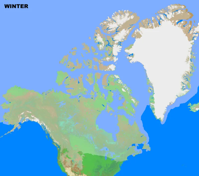
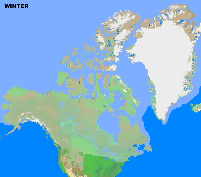
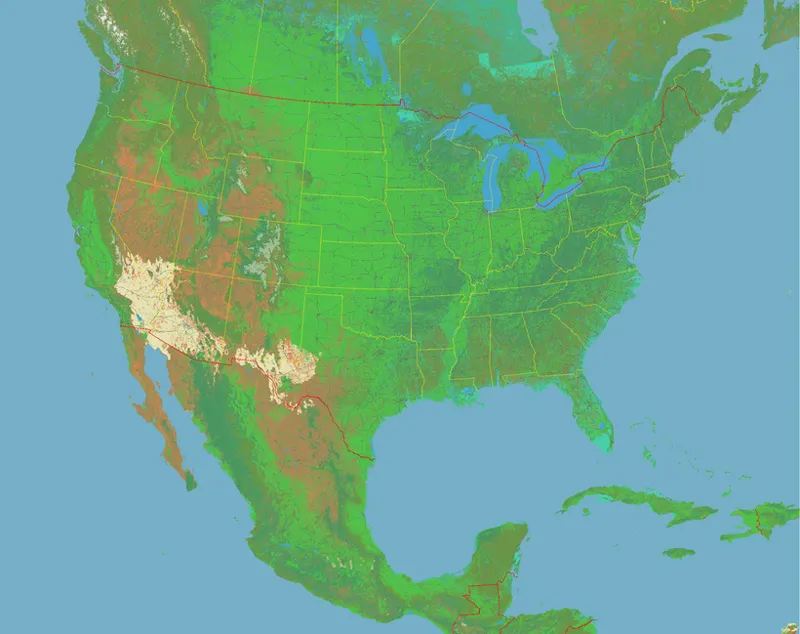
This is the result for winter and summer, as seen from the map preview for a 1:1000 scale map of North America:
Snow is based on monthly mean temperatures from the ECMWF ERA5 climate model, while snow cover is based on polar ice extent data from the Met Office's OSTIA (Operational Sea Surface Temperature and Ice Analysis) dataset.
When snow conditions are met, non-snow biomes are converted to vanilla snow biomes. This allowed the following new biomes to be added to the maps:
Snowy Plains
Snowy Slopes
Snowy Beach
Snowy Taiga
Grove
Frozen River
Frozen Ocean
Sea Surface Temperature based Ocean biomes
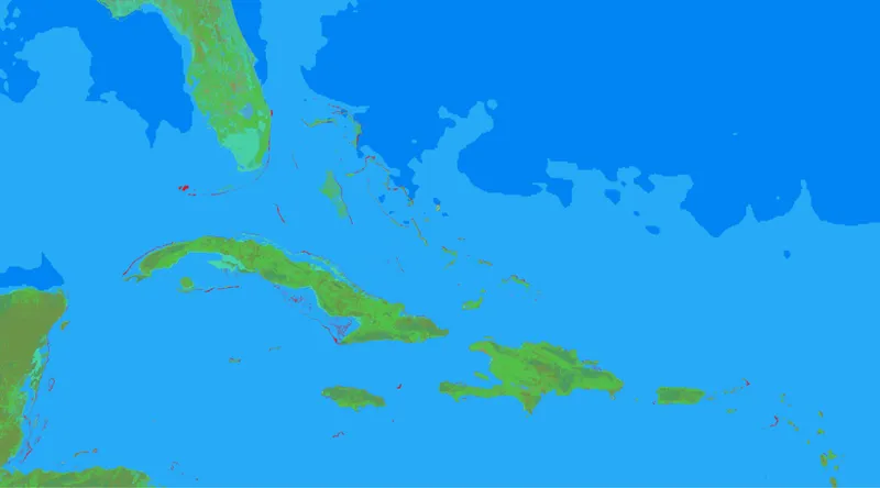
Furthermore, based on the sea temperatures of the OSTIA dataset, three new marine biomes are now used, dividing the ocean into three classes:
Cold Biome when the monthly averaged SST is below 15°
Ocean when the monthly averaged SST is between 15° and 25°
Lukewarm Ocean when the monthly averaged SST is above 25°
Coral reefs
I've also added coral reefs to the maps, using the Warm Ocean biome where a coral reef is observed in the Global Distribution of Coral Reefs dataset
Fixed grass/foliage colors
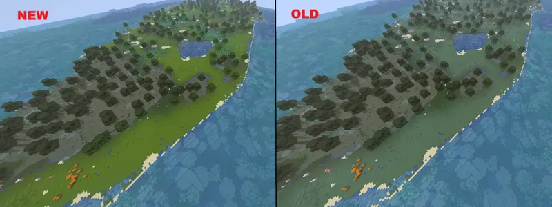
Since the very first release of EarthToMC, due to biomes temperatures changes to handle the snow, the grass/foliage color was darker than the vanilla one in certain maps. This issue is now fixed, the color will be not dependent on temperatures anymore
Custom Map Projections
An example of a working Lambert Conic Conformal projection on a low res USA map In v1.8
Instead of manually writing the EPSG code, it will be possible to choose a compatible projection using a drop-down menu
All the EPSG and ESRI codes with meter as unit measure should be compatible now, but the Custom Projections feature remains an experimental feature: it's trial and error
Overview of the software: EarthToMC v1.8-beta [2025/09/08] - Generate a Minecraft Map of any place of the world | Patreon
Download post: EarthToMC v1.8-beta [2025/09/08] - Download and Installation tutorial | Patreon
Full changelog
[NEW FEATURE] It's now possible to specify a season for computing the snow cover instead of using a global fixed snow height value: snow cover is realistically based on Climate data from ECMWF ERA5 dataset
[NEW FEATURE] Sea Ice is now included into the maps and it's based on the selected month to be used as reference for climate in the map (it will appear as Frozen Ocean biome)
[NEW FEATURE] Added coral reefs to the map, they will appear in game as Warm Ocean biome
[NEW FEATURE] Added 2 new ocean biomes basing on the sea surface temperature for the selected season: Cold Ocean where the SST is below 15°C, Lukewarm Ocean where the SST is above 25°C
Thanks to the new climate generation system, 7 new snowy vanilla biomes are added in the maps (Snowy Plains, Snowy Slopes, Grove, Snowy Taiga, Snowy Beach, Frozen River, Frozen Ocean)
Fixed a bug causing the color of grass and foliage to be darker than vanilla in certain types of maps
Fixed missing snow and glaciers in Greenland and Antartica
Fixed missing terrain elevation in Greenland and Antartica when doing a map with resolution between 100m and 1000m
Fixed missing dirt terrain areas in Northern Canada and Greenland above latitude 80°N
Fixed a bug causing missing terrain elevation in the northern hemisphere when generating a map across the equator
Fixed a bug causing missing roads when generating low resolution maps with roads (introduced in v1.7)
Fixed a bug causing a critical error when doing high resolution maps without buildings (introduced in v1.7)
Fixed a bug while downloading the land cover dataset when doing a map across longitude 0 (Spain/France/UK bug)
Fixed a bug causing missing land use datasets (biomes) in New Zealand
Better drawing of certain types of raceways
A list of compatible custom projections for the selected area will be shown instead of manually having to write the EPSG code. Custom projections are still an experimental feature.
Fixed a syntax error when generating the datapack (introduced by mistake in v1.7)
Fixed a bug when not specifying the paths for the QGIS project / WorldPainter Tiles, leading to a not successful start of the generation (blank logs, no progress at all)
Extended compatibility of the Journeymap waypoints with more types of custom projections

Comments (1)
Hi, I downloaded the software but every time I download something from the Earth it gives me error 38 and error 75. This happens every time progress reaches 55% and then lib.png errors show up in the terminal. I spent hours last weekend trying to figure it out. These errors are posted on Discord.