






EarthToMC v2.1 [2026/06/25] - Generate a Minecraft Map of any place of the world
EarthToMC V2.1 - NEW UPDATE 2026/06/25 - Create highly customizable and detailed Minecraft maps of any part of the world
NEW UPDATE 2026/06/25 - EarthToMC v2.1
What's new on EarthToMC?
Support for Minecraft Java 26.1, 26.1.1, 26.1.2 and 26.2
[NEW FEATURE] New "Vanilla caves & ores (Underilla)" underground type for Minecraft 1.21.5 or later: after the world is generated, vanilla underground is merged beneath the surface using the Underilla plugin on a temporary local Paper server. Customizable settings for controlling vanilla caves & carvers, ores/decoration, structures and more
[NEW FEATURE] Added a "Merge multiple .world tiles into a big WorldPainter project" option that will merge the WP .world tiles into one big tile before manually editing the maps. This feature is experimental and increases the risk of out of RAM issues
Rivers and lakes on maps with a scale greater than 30m now use OpenStreetMap data, with more realistic river widths compared to the less precise Natural Earth data
Rivers are now classified by their real length into three categories: major (> 400km), regional (100 to 400km) and minor (< 100km). It's now possible choosing which categories to include in the map
Added a "Make important rivers (length > 400km) even wider" option in Advanced Mode, to be used alongside the existing "Make rivers wider" option
Fixed a major bug where river and lake depths were not properly rounded between the floor and the coast (bug introduced in v2.0)
Added an option called "Pre-generate the world after the worldpainter export stage ends" that will let Minecraft populate the whole map using a Paper server instance after the WP export stage
Fixed a bug where the "Cut bathymetry below y=-64" option could leave voids in the deepest sea floor areas; the sea floor is now clamped one block above bedrock (y=-63)
Faster biome classification stage with a significantly lower RAM usage, reducing out of ram errors (Error code 20) especially on Biomes O' Plenty and Terralith maps
Fixed a bug where some islands inside rivers and lakes could be submerged by the water and disappear from the map
Fixed a bug where using a decimal terrain exaggeration value (e.g. 5.5) could cause coastal and low-elevation areas to appear below the water level due to an elevation mapping precision error
Tiny isolated ponds (smaller than 4 km²) are now excluded from low resolution maps (> 30m) in order to avoid "random puddles of water"
Fixed OpenStreetMap tiles occasionally showing "403 Access blocked" in the map viewer due to missing HTTP Referer header
Fixed a bug where the "Remove lava lakes" option and custom trees vanilla tree removal had no effect on many biomes such as Jungle, Savanna and others due to a datapack issue
Steep desert slopes now use a sandstone terrain instead of plain sand: sandstone is applied where the slope is greater than 15 degrees within the Desert biome
Replaced coarse dirt terrain with dirt path terrain for a more natural looking transition between deserts and grassy areas
Fixed a bug in the "mountain_steppe" terralith biome causing a "Safe Mode" warning when loading a world in certain mc versions
Fixed a bug causing river biomes to be applied in certain areas where rivers are not there
Better classification of arid regions (biomes and terrain type) in certain Middle East areas
Fixed a bug where rotated maps that include OpenStreetMap roads & buildings could fail with Critical Error 20 during the biome classification stage
Fixed a bug preventing the resume of an unfinished map on native Linux (non-WSL) systems, where pressing "Yes" in the resume dialog did nothing
Fixed the auto-detection of the default Minecraft and Desktop folders on native Linux (non-WSL) systems
Fixed a bug while trying to do a full Earth map with custom projections in certain scenarios (bug introduced in v2.0)
Fixed a bug when using certain custom projections (bug introduced in v2.0)
Fixed a bug causing syntax errors to be written in the datapacks (even if they were not causing issues in-game)
Safer method of processing of the Biome Classification algorithm in order to avoid Critical Error 20 especially on certain linux setups
Fixed a bug where custom trees layers were silently dropped on Terralith maps in certain scenarios leaving the affected biomes without any trees
It's now possible to manually select "Wayland" or "XCB" as graphic backend in "Preferences" in case of issues with graphics / multi-monitor setups
Fixed a bug where the final compression to .7z could fail silently (e.g. due to I/O errors / full disk) causing no world to be saved at all
FULL CHANGELOG --> https://earthtomc.com/app/CHANGELOG.txt
-------------
Where to Download:
To get access to EarthToMC, you’ll need to subscribe to a Top Tier or higher membership on Patreon. Once you do, you’ll be able to see a post detailing how to install the software!
LATEST STABLE RELEASE
EarthToMC v2.0.1 [2026/06/25] - Download and Installation tutorial | Patreon
By downloading and using this software, you agree to the End User License Agreement (EULA) and the Disclaimer. This software is provided as an original intellectual work; the Patreon tier grants a license to use this version of the software.
-------------
Join us on Discord: https://discord.gg/SXvNS8x2pJ
Screenshots:
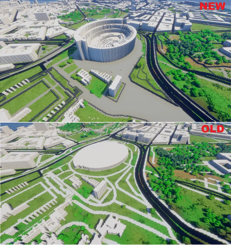
Colosseum, Rome, Italy
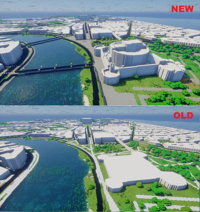
Castel Sant'Angelo - Rome, Italy
Italian Alps 1:5 scale
Large scale map of USA - Details of Delmarva Peninsula
Kansas City, USA
Southwestern Utah, USA
Central Park, New York City
Tokyo, Japan
How the software works:
When you open the software, you can use an interactive graphical interface to select an area of interest for map generation, specifying the map’s scale as well.
Any map with a scale between 1:1 and 1:5 can include all the city details available in OpenStreetMap—such as buildings, roads, railways, airports, parking lots, and more.
Maps with a scale greater than 1:5 will, by default, include only natural features, with the option to add major roads and railways.
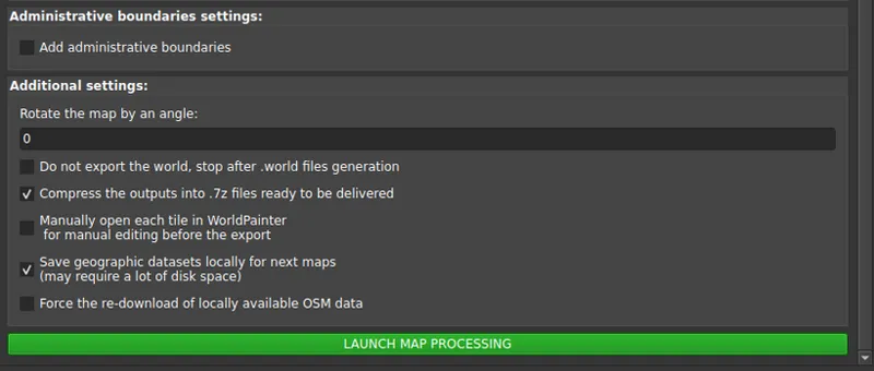
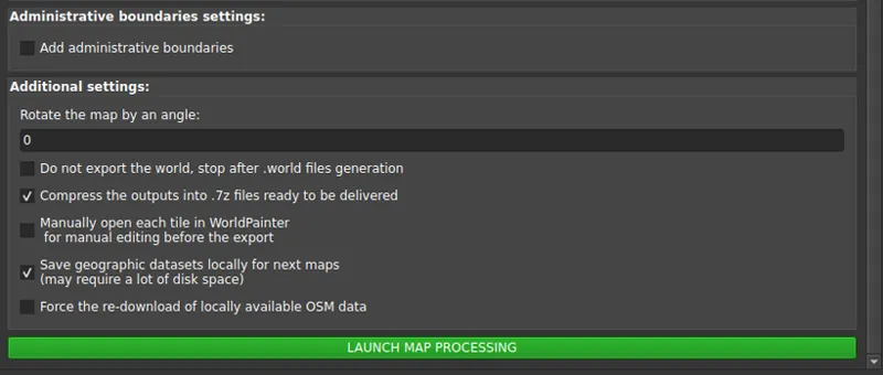
Dozens of configuration parameters are fully customizable by the user, and the application does the rest! From downloading the necessary data to processing it, and finally loading and exporting it into WorldPainter to produce the playable map.
All you have to do, once the map is configured, is start the processing and wait. For smaller maps (under 10,000 x 10,000, designed for individual users), it takes just a few minutes. For huge maps (100,000 x 100,000, designed for larger servers), it can take a few days.
Main Features of the Software:
Generates Minecraft maps for every version from 1.17 up to 1.21.11 (the latest), covering any area worldwide, with scales ranging from 1:1 to 1:2000.
Uses WorldPainter for converting geographic data into Minecraft elements, creating fully editable .world files for users and map makers.
Offers the option to save GeoTIFF files for each layer and a QGIS project, allowing you to see a preview the final map while the map is generating.
Automatically generates the correct datapack to handle altitudes beyond standard limits.
Lets you set a “snow line” based on altitude.
Integrates buildings, roads, railways, airports, and other urban elements from OpenStreetMap.
Integrates rivers, lakes, coastlines, swamps, glaciers, permanently snow-covered areas, and vegetation from OpenStreetMap.
Retrieves terrain elevation from high-resolution DEM datasets (USGS 3DEP, NASADEM, Aster GDEM, GMTED DEM).
Determines biomes and vegetation using high-resolution land-use datasets (USGS NLCD and GLC FCS 30).
Identifies desert and arid areas using Sentinel-2 data and the Global Aridity Index.
Snow and ice extent using ECMWF ERA5 Climate data and OSTIA SST dataset
Allows adding national, regional, and provincial boundaries (states and counties in the USA).
Supports creating maps at a scale more detailed than 1:1, up to 10 cm in the real world per Minecraft block (ideal for highly detailed building projects).
Enables rotation of the map to a user-defined angle for the best representation of buildings
Splits the map into tiles, making processing feasible even on older or less powerful PCs.
Software screenshots
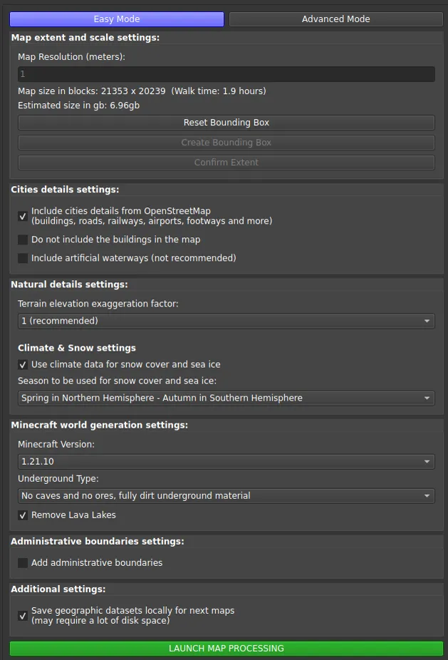
Easy mode
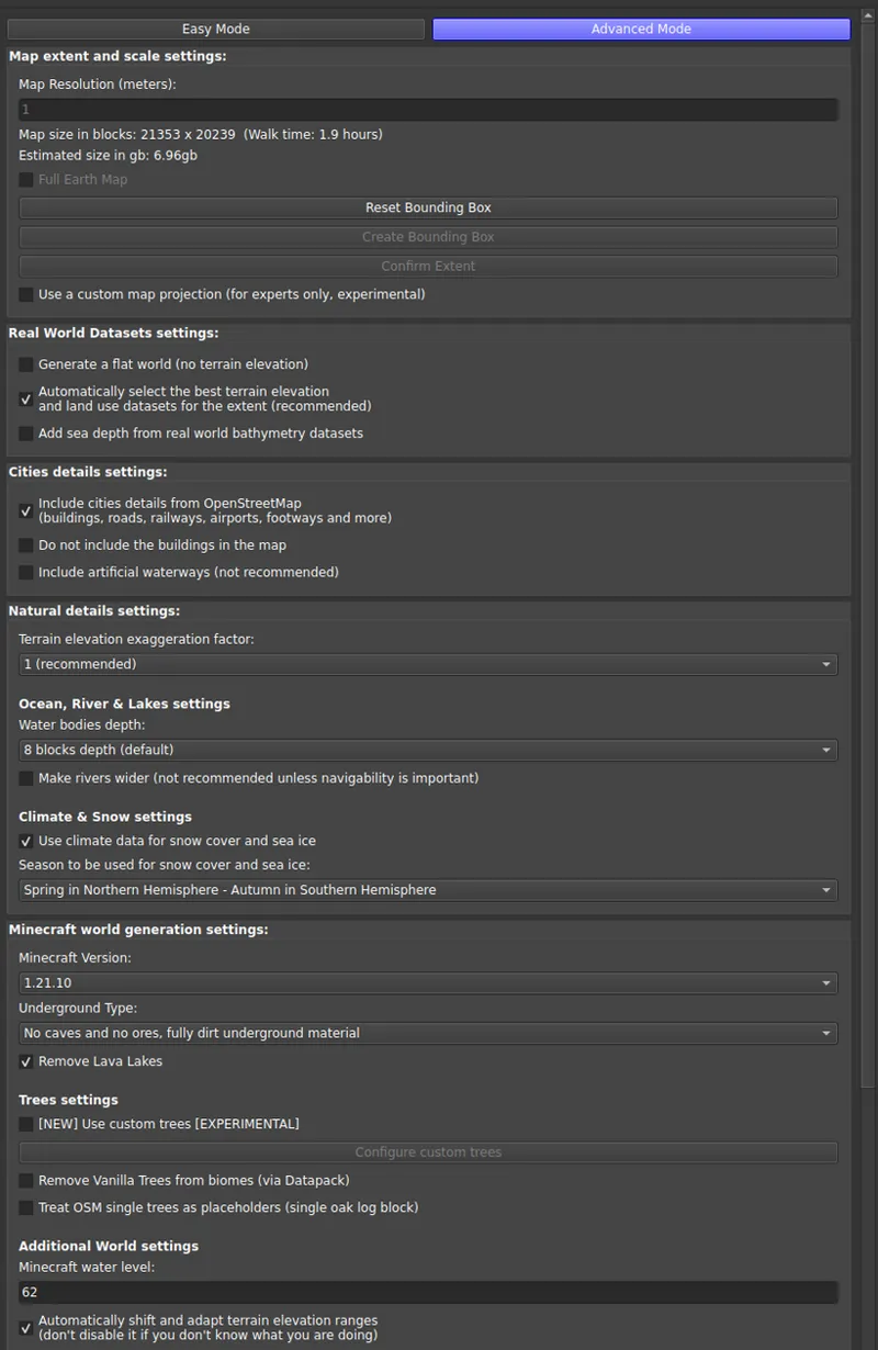
Advanced Mode
Selection of the .minecraft folder and where to save the Worldpainter files + QGIS
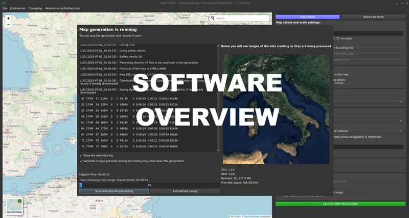
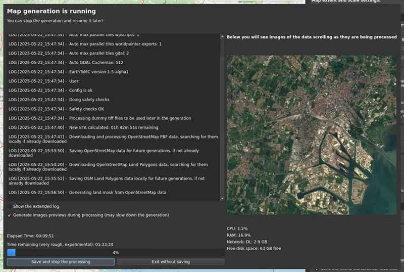
Map generation
QGIS Project view of Zion National Park, Utah
3D View of Zion National Park, Utah, using WorldPainter
2D View of Central Park in New York City using WorldPainter
3D View of Central Park in New York City using WorldPainter
Minimum Requirements:
Quad-core processor
8 GB of RAM
A stable internet connection with a minimum download speed of 20mbps
Windows 10 (Build 19041 and higher) or Windows 11 - Linux
Minimum 32gb of disk space, consider using an external hdd for big maps
ARM is currently not supported
Technical Details:
For the more technically inclined, the software is written in Bash and uses a Python (PySide6) graphical interface for configuration and launching the Bash script that handles actual map generation. During the process, GIS software such as GDAL, QGIS, osmconvert, osmfilter, and various Python libraries are used. For running on Windows, the software relies on WSL (Windows Subsystem for Linux).
Where to Download:
To get access to EarthToMC, you’ll need to subscribe to a Top Tier or higher membership on Patreon. Once you do, you’ll be able to see a post detailing how to install the software! (EarthToMC v2.0-beta - Download and Installation tutorial | Patreon)
By downloading and using this software, you agree to the End User License Agreement (EULA) and the Disclaimer. This software is provided as an original intellectual work; your Patreon tier grants you a non-exclusive license to use this version of the software.
Join us on Discord: https://discord.gg/SXvNS8x2pJ
© 2026 AtmosphericBeatsMC. All rights reserved