

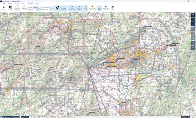


1:500.000 Cold War Germany Aeronautical Chart for CombatFlite
You'll find attached an historical 1:500.000 aeronautical chart for West Germany. That chart is accurate for 1976, and is therefore perfect for those trying to achieve a high level of realism on DCS CW Germany theater!
Note that this chart has been produced in collaboration with one of our members, Rohrkrepierer from JaBoG 35: after months of active search online, he managed to buy these original paper maps and have them scanned in high resolution. Once this was done, the easy part began: georeferencing them and transforming them in .mbtiles for CombatFlite!
You now have a full composite map for West Germany, covering most of the current DCS theater. Additional coverage for the southern regions will be added later.
For those interested, you'll also find attached the full legend for this map. You'll notice in particular nice details, like the low level training areas (where flying at 250' was allowed), and the low level transit routes between these areas.
Attached below are the .mbtiles for use in CombatFlite, as well as the same map in .png and .jpg format. The major difference between the .mbtiles format and image files is the projection: the .mbtiles EPSG:3857 projection cannot be used for manual flight planning due to the map distortion (all meridians are parallel in this projection). Instead, the image maps use a conical orthomorphic projection, that keep distances correct over the whole map.
Enjoy your planning!