
ISAF 2009-2013 - ACO Building - IFR & VFR Transit Trough Pakistan - Kneeboards (8/x)
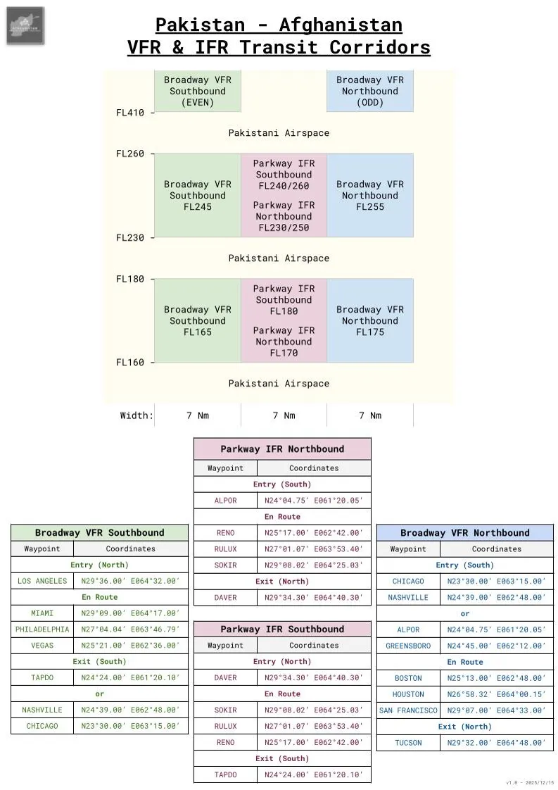
Here is my own trial at recreating the IFR and VFR transit corridors through Pakistan, as they have been described previously.
You'll notice that in the South, the corridors start or end either from existing IFR waypoints in the Muscat FIR, or for naval operations from ad-hoc waypoints that will be close to the CVOA (Carrier Operating Area). In that case, "Redcrown" would be the receiving agency.
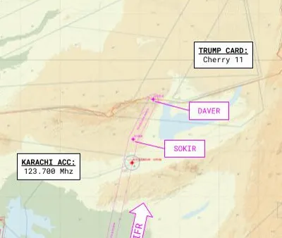
As a side note, you can see that the civilian frequencies are directly indicated here (open source, as per Pakistani AIP), while military ones use the "color code".
In Afghanistan, the corridor links with an existing airway, so as to rejoin seamlessly the IFR transit in the country. In VFR, aircrew are in a "see and avoid" flight environment once in Afghanistan, and they can transit directly to their tasked area. Contact with Tactical C2 (Trump Card) from the border was not always guaranteed, due to poor radio communications, especially when no AEW aircraft were present in the Southern part of the Afghan AO.
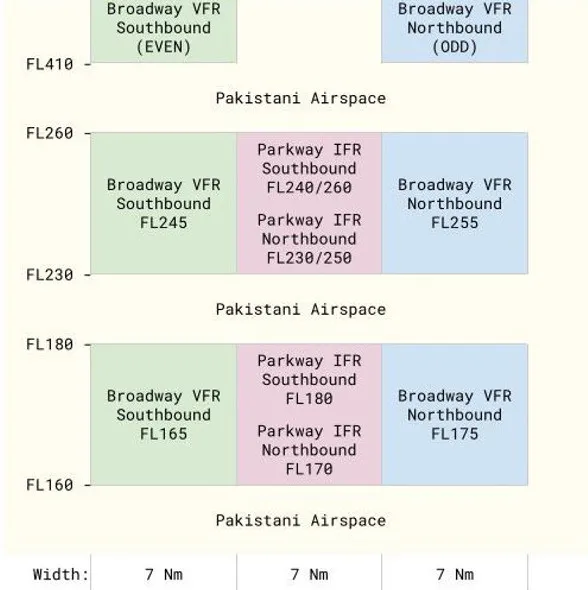
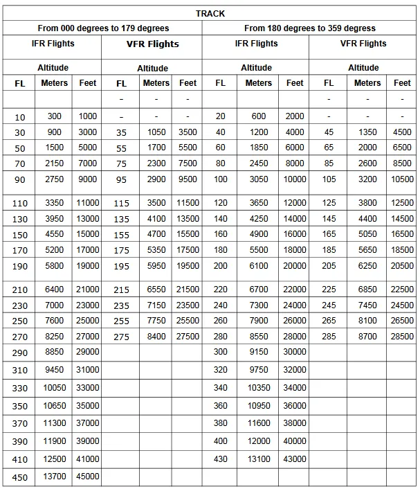
In the vertical plane, we can note that airspace above FL400, that is seldom used by civilian liners, is made available to fighters, in order to benefit from the best fuel performance at very high altitude. At such altitudes, the meteorological conditions are (nearly) always VFR, and the primary difficulty would be to handle the descent through clouds either in the AO, or towards the aircraft carrier.
It also follows the "semi-circular" altitude rules used in Pakistan, as described in their AIP. We can note that the VFR flight levels above FL400 are a deviation to their standard rules.
As usual, you'll find the corresponding .cf file in addition to the .pdf version of the attached pictures.