
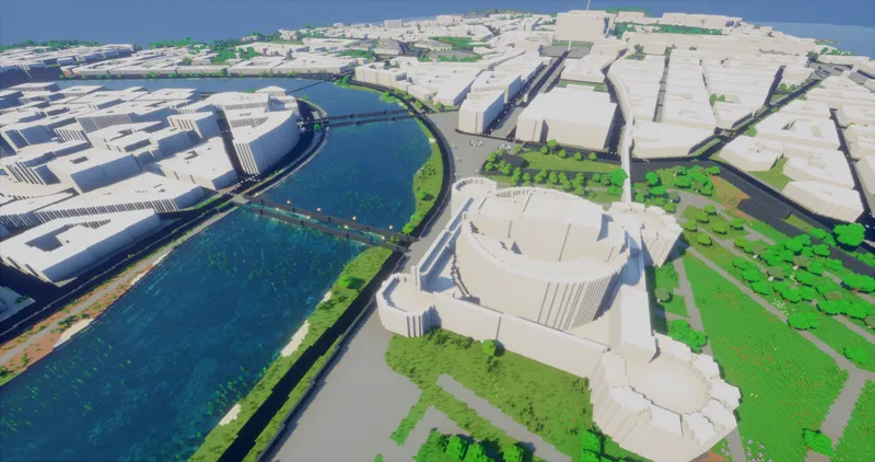






About the new cities details update in EarthToMC v1.7
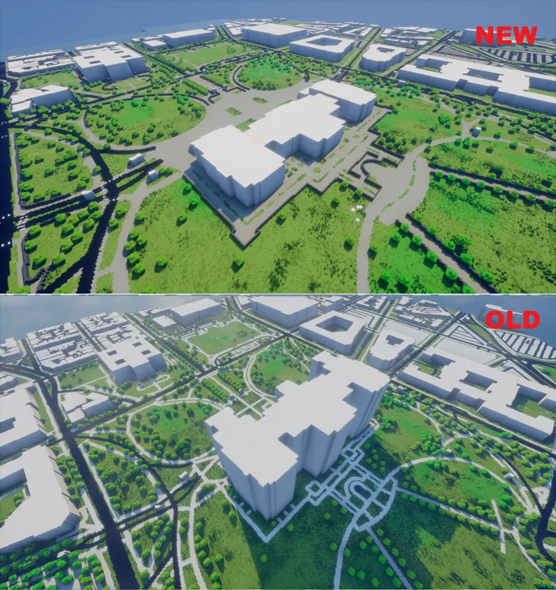
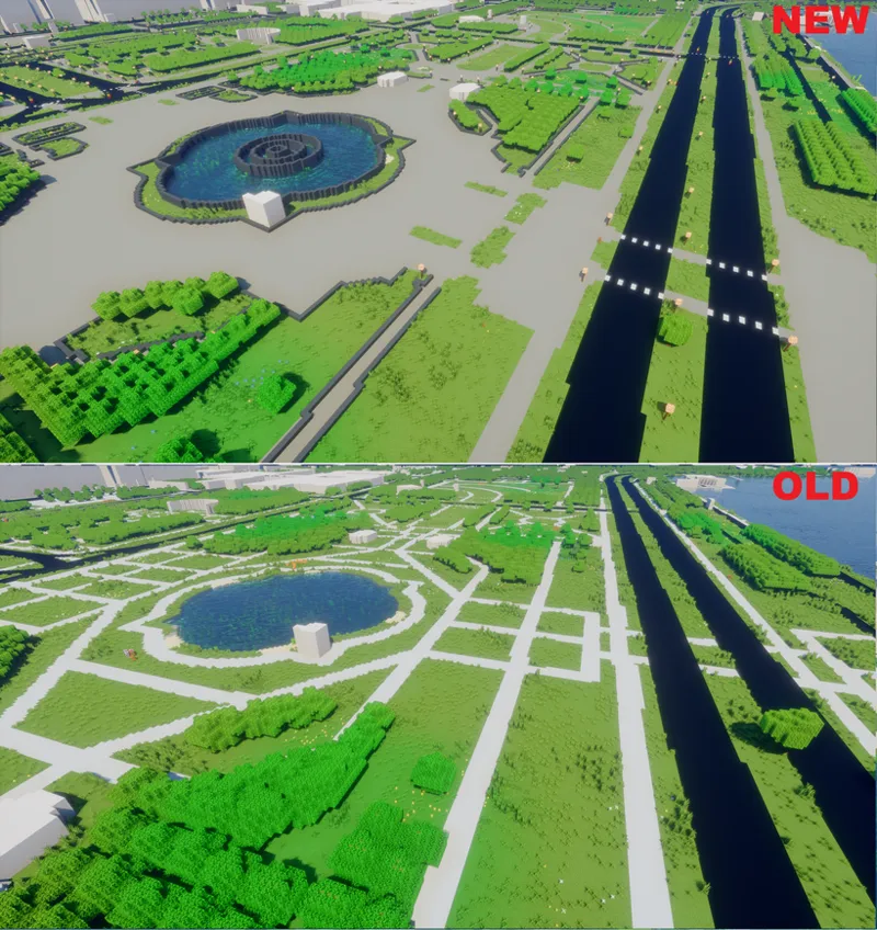
Recently I've been working on an important update of the details of the cities, trying to maximize the use of informations from OpenStreetMap: this update is also the first development of cities details since the very first release of EarthToMC
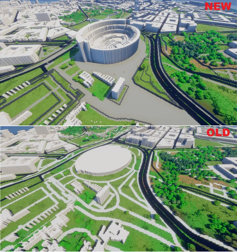
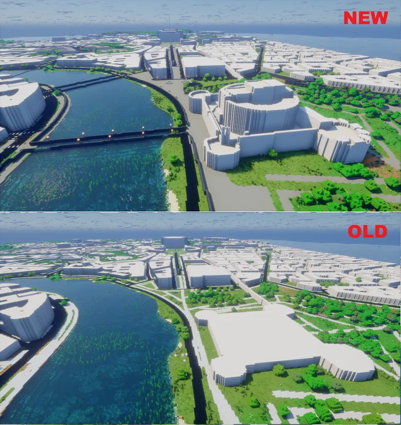
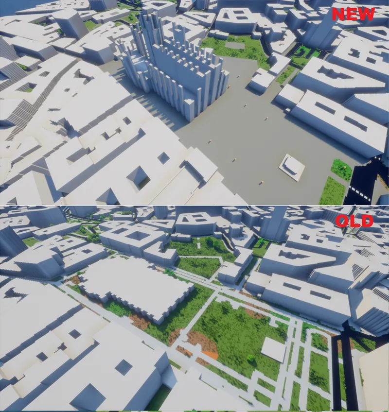
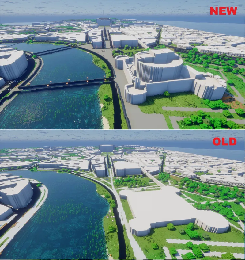
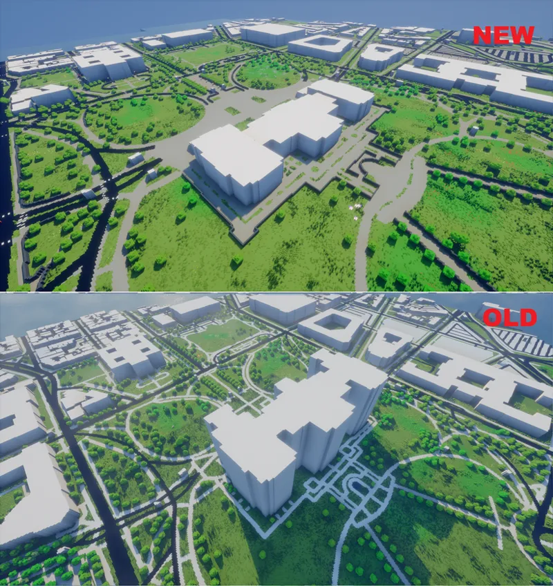
Since in OpenStreetMap, in certain cities, complex buildings are composed of multiple parts, I've developed a new method for the rendering of the buildings which outperforms the current simple rasterization method based on applying the maximum building height for every part of a specific building
This allows for massive improvements of buildings shapes and heights, as you can see from those examples:
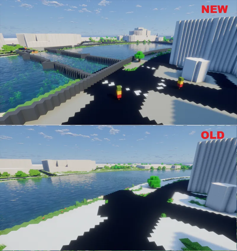
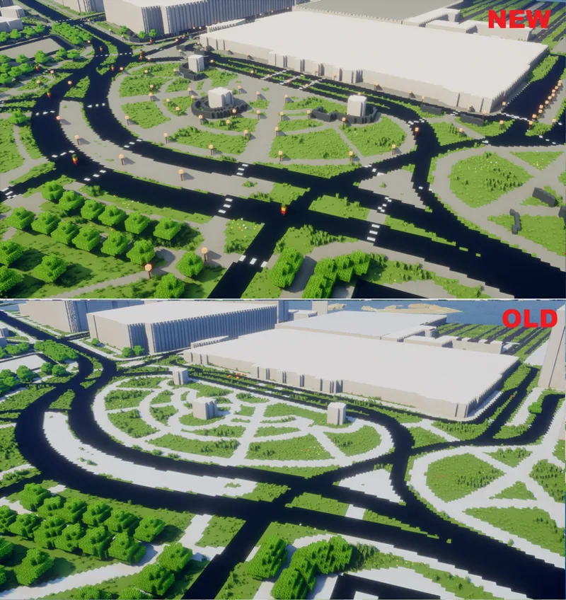
The update also adds new elements in the maps, such as:
Walls, barriers, city walls, fences, gates
Paved surfaces
Street lamps
Pedestrian crossings
Piers and breakwaters
Traffic lights
Meadows and gardens
Single trees located where they are in real life have been improved compared to last version
There's still margin for optimization, on the next updates I'll focus on:
Including building roofs shapes
Using different materials for certain types of buildings
Including bridges and tunnels
Make it possible to have the buildings empty inside
Adding all the missing buildings in OpenStreetMap using Microsoft Buildings Footprints (microsoft/GlobalMLBuildingFootprints: Worldwide building footprints derived from satellite imagery)
The update will be released in v1.7-alpha1 today for Map Lover Tier subscribers. It will be available for Top Tier subscribers in v1.7-beta at the end of the month
Comments (2)
i had a question about how it works. i've tried out the massive continental U.S. map and noticed its curvature, would all large maps have that same curvature or is there the ability to change map projections
High resolution maps of small areas use the UTM projection by default, while when doing continental maps the Web Mercator projection is used by default Anyway in EarthToMC it's possible to specify a custom map projection by specifying an EPSG code